Overall, the EU Biodiversity Startegy 2030:
- protects sensitive marine species and fish stock recovery areas (more Natura 2000 protected areas)
- eliminates destructive fishinh activities
- builds a consistent EU Nature Restoration Plan
- leads to a global biodiversity framework including biding ocean restoration targets
- is the core part of EU Green Deal
Earlier this year, the Programme Director at Our Fish, Rebecca Hubbard shared her view on Euronews pointing out the correlation of ocean’s problems (like overfishing) with the European Commission’s Strategy.
“We must put an end to this cognitive dissonance: we cannot claim to be saving nature or to be taking impactful climate action while celebrating continued ocean destruction.”
One of the EU next year plans, is to urge the Member States to adopt ecosystem- based Maritime Spatial Plans (MSPs) which will include specific obligations for the governments to fully protect at least 30% of marine protected areas (MPAs) and areas with intensive human activities based on their ecosystem sensitivity.
How can the satellites protect our MPAs?
Our satelites are the Earth Observers or our planet’s hereos which can "see the sea" in ways that are otherwise impossible. Do you remember the super heroe in the movie „Toy Story”?
Satellites are amazing tools for observing the Earth and the big blue ocean that covers more than 70 percent of our planet. By remotely sensing from their orbits high above the Earth, satellites provide us much more information than would be possible to obtain solely from the surface.
Our Marine Protected Areas (MPAs) need to be monitored as they play a vital role in protecting and preserving our global ocean ecosystems. 10% of the world’s oceans could be marine reserves by 2020 if UN goals are met. However, those targets remain on paper without a practical implementation.
Which can be the solutions?
A vital solution lies in the use of satellite-interfacing sensors and data processing tools that are beginning to allow us to watch how ships use the oceans as easily as we track Uber taxis cruising around a city. More and more ships now carry sensors that publicly transmit their position to the satellites, to have a map of the traffic and avoid crashing into each other. We can make use of these same streams of safety data to detect where industrial fishing is concentrated. Smart new algorithms can help pick out specific kinds of vessel behaviour using big data and tracking their fingerprints.
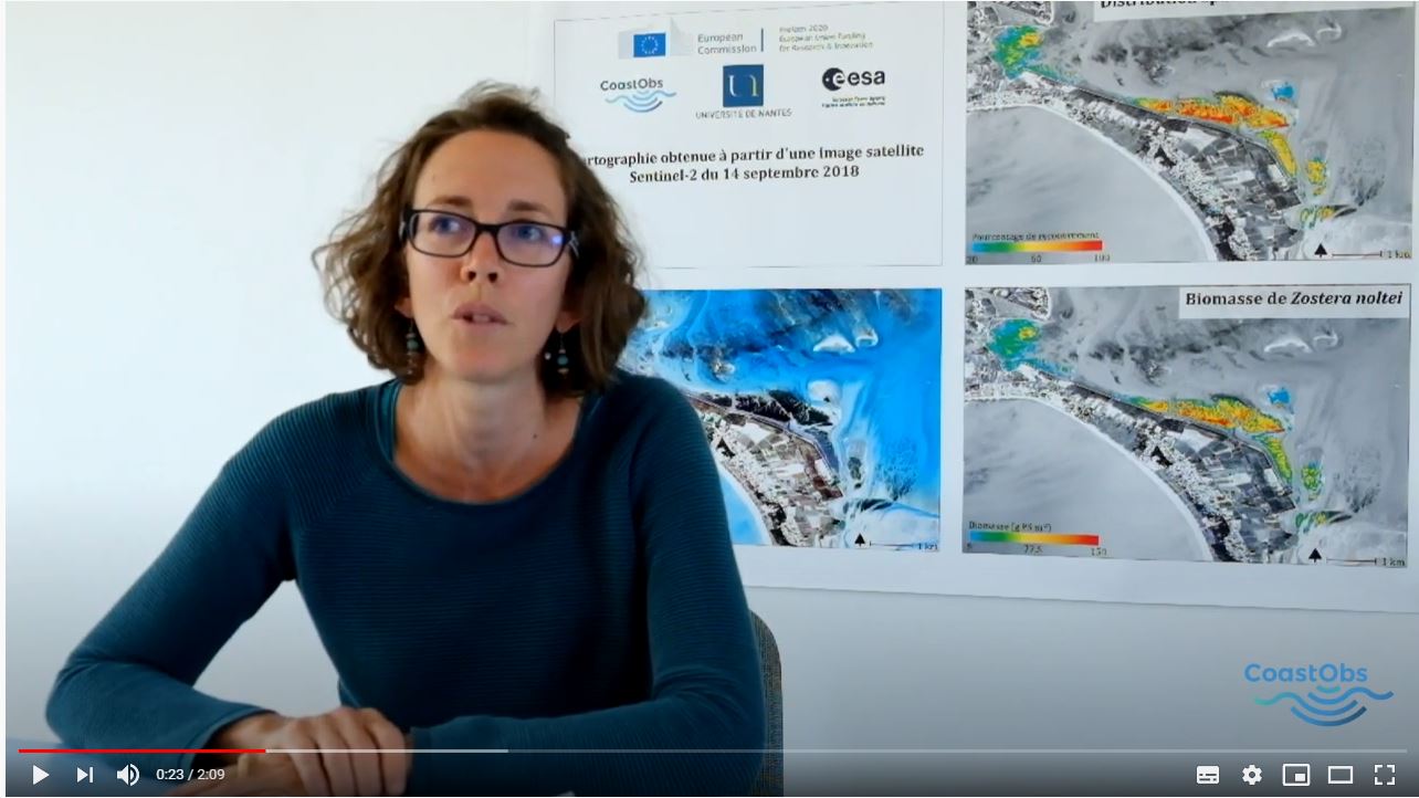
Another important piece in the ocean-observation puzzle are the high-resolution pictures from Earth that allow marine scientists to observe the Ocean and inform about , marine habitat mapping and monitoring, track anthropogenic activities and assess its impacts on biodiversity in MPAs[i].
Applications of remote sensing on Ocean observation
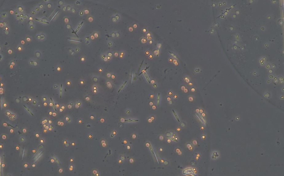
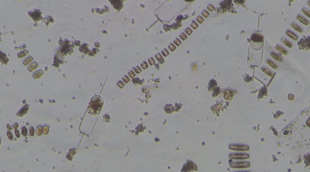
Monitoring Phytoplankton via satellites
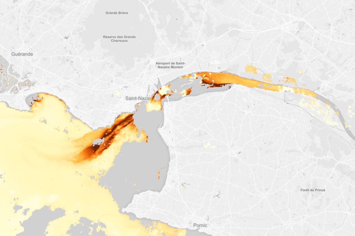
The tiny phytoplankton found in the world's ocean is tremendously productive, as it creates half the oxygen we need to breathe, produce carbohydrate which is used as an energy source and are an essential food source for small crustaceans, fish and mussel larvae, which are themselves food for larger fish. If phytoplankton is in shortage, the whole food chain is jeopardised. There are various groups of phytoplankton around the globe with different functions in marine ecosystems. Until recently, it was impossible to track those phytoplankton groups. Even satellite data were unable to predict phytoplankton concentrations and algal growth in specific regions.
But technology progress and new opportunities are popping up. CoastObs is developing a service to be able to monitor phytoplankton size classes and primary production.
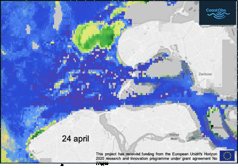
This new algorithm is important to help us preserve our marine areas but it will also help us identify toxic "harmful algal blooms" (HABs) and maintain good water quality. CoastObs is already providing a weekly bloom monitoring service to the Netherlands, but once CoastObs platform is released, this product can be asked for any other region in Europe.
The platform will also help monitor seagrass and macro-algae cover, which will be extremely helpful to monitor the Marine Protected Areas that have these ecosystems.
Remote sensing for Ocean monitoring shows great promise to support wildlife managers in their efforts to protect marine biodiversity around the world, and the great news is that innovative products for water monitoring keep developing!
Let’s use the modern technology and satellites capacities to save our seas and their rich aquatic ecosystems. Our ocean is our home and this is the main message of this year’s global campaign.
Do you want to join?
Share your views today using #WorldOceanDay #ProtectOurHome
https://oceanservice.noaa.gov/facts/why-care-about-ocean.html
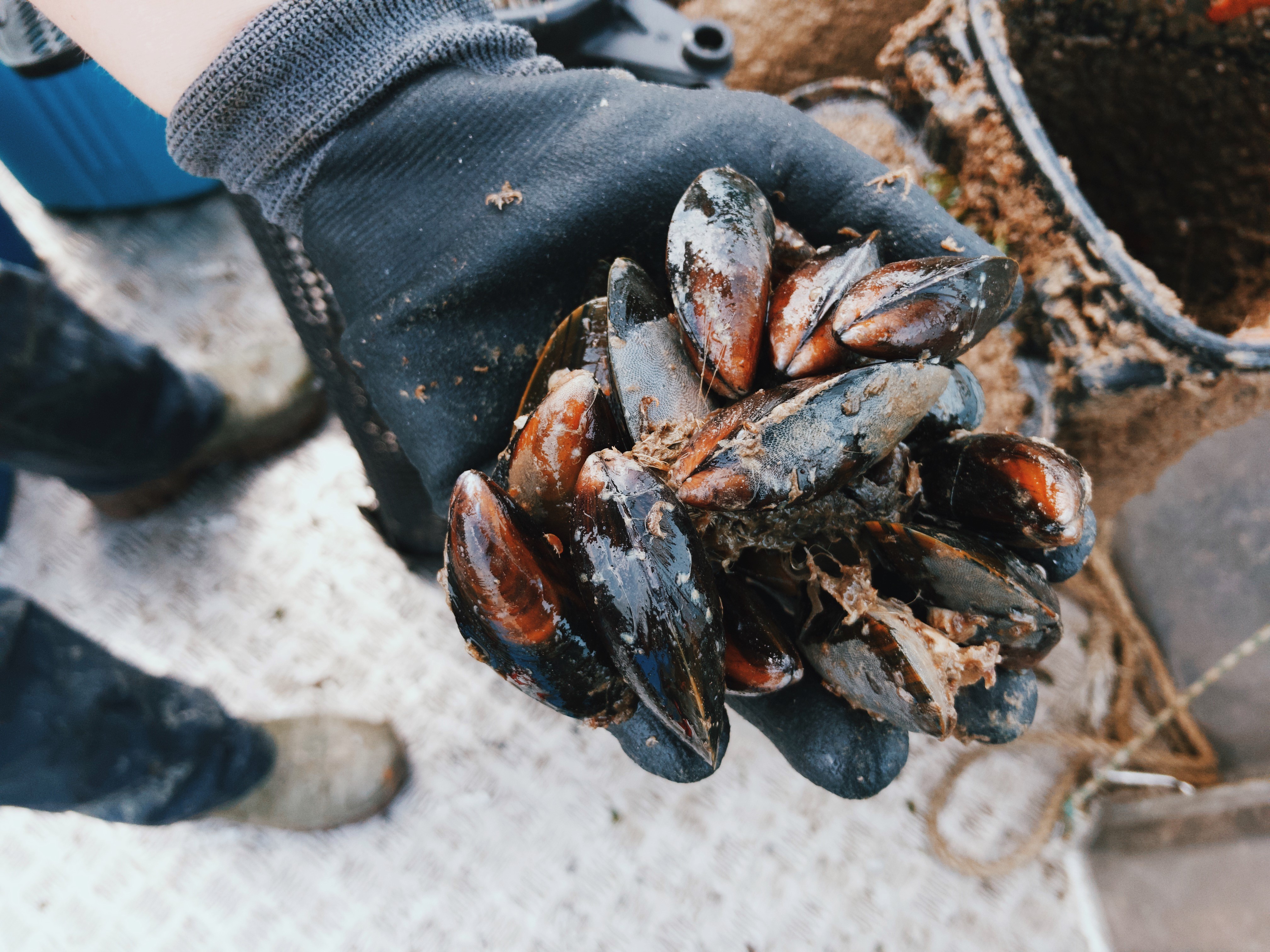
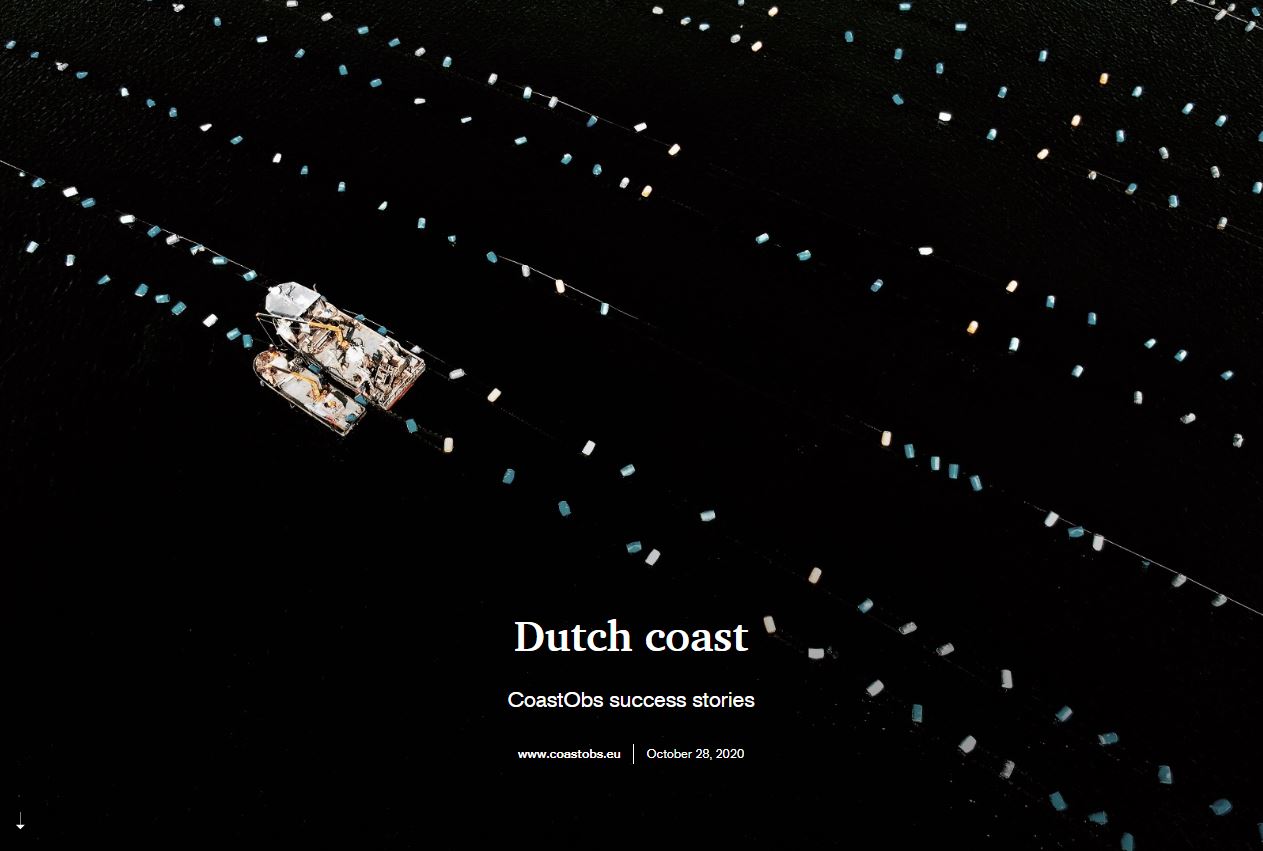
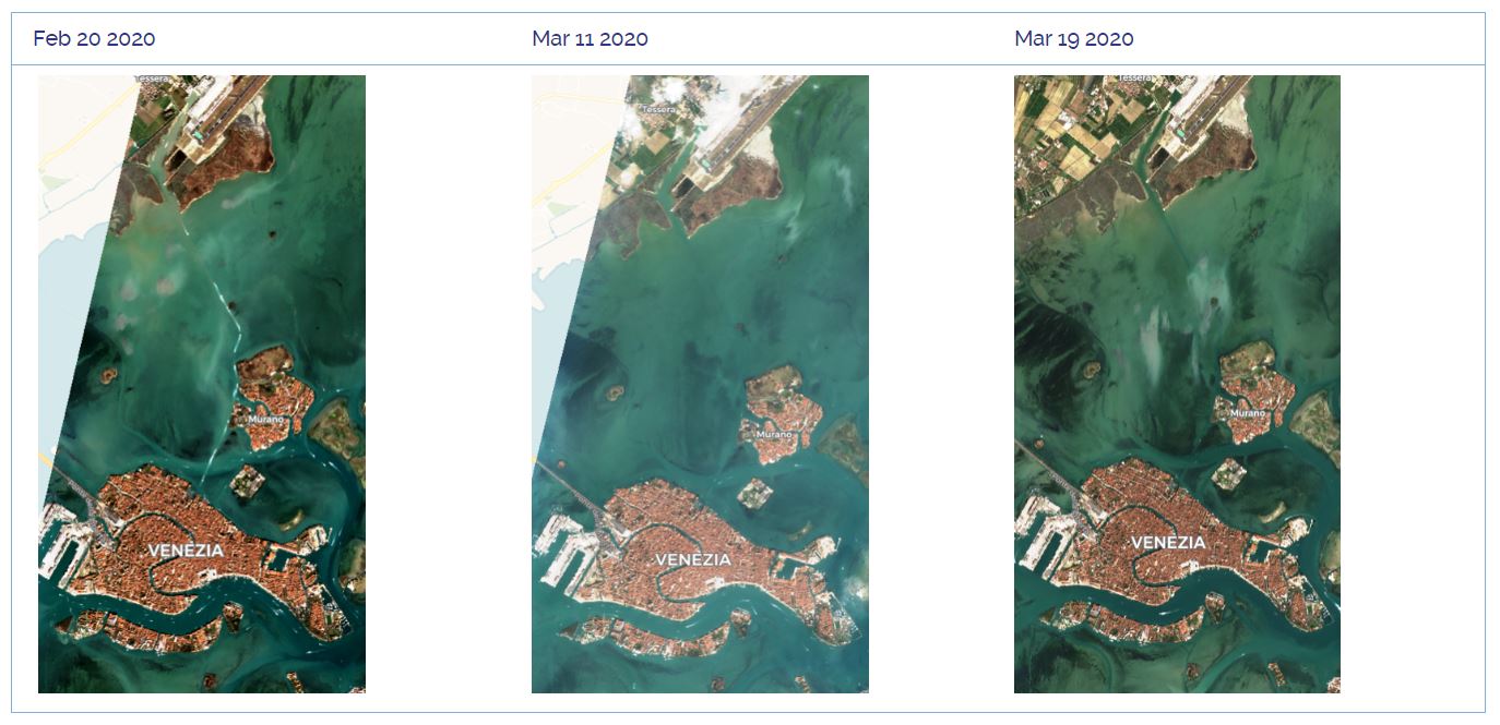
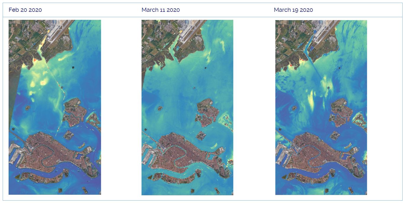
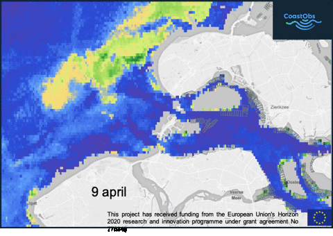
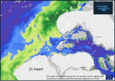
 A species that can cause harm to shellfish along the Dutch coast is Phaeocystis. Not so much because of its toxicity, but because the decomposing of a large bloom can cause lack of oxygen in areas where shellfish are cultivated. Mortality of shellfish will occur to some extent, as has been the case a few times in the Oosterschelde estuary over the past years. Phaeocystis cannot yet be identified in the manner by which Pseudo-nitzchia can be identified from remote sensing, but high intensity blooms can be derived from EO chlorophyll-a maps.