University of Nantes and Biolittoral have met end-users on the 19th and 21th of March to deliver WP3 intertidal seagrass products from CoastObs case-study in Bourgneuf Bay.
]]>


University of Nantes and Biolittoral have met end-users on the 19th and 21th of March to deliver WP3 intertidal seagrass products from CoastObs case-study in Bourgneuf Bay.
]]>
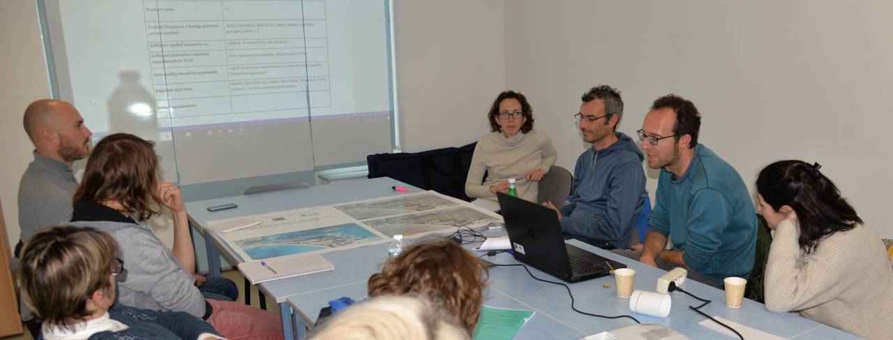
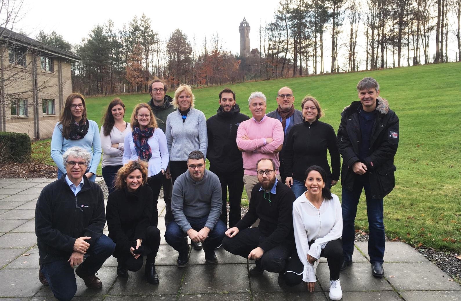
This month CoastObs turned one year old! This coincided with our 3rd project meeting and 1st review meeting, so we all got to gather in Scotland where we were hosted by our partner The University of Stirling.
]]>After our meeting in Venice, the consortium didn't have the chance to meet alltogether until this November. The first two days in Stirling we focused on our project meeting and on planning what is coming for the next period. We must say we are very content to where we are at and what's upcoming, so keep updated because this second year will be very exciting!
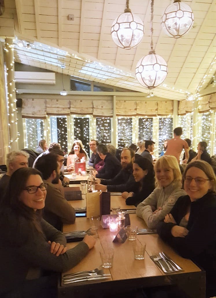
And well, because meetings are also important to bond and catch up on other areas, we had a very tasty dinner altogether. This has been always key on having a great consortium communication and cooperation.
On the second night, after the longest day in the agenda, we got to hang out with our Project Officer and Reviewers previous to the review meeting day. We were very happy to get to know them and relax around them.
The third day in Stirling was fully dedicated to make a recap on what have we done along this first year of CoastObs. We presented to our PO and reviewers the things we planned, what we have achieved and a short overview of what is coming next. It was very good to have their comments and feedback. Did you follow our live tweets in our account?
Before the year comes to an end we still have some activities to run. For example, the University of Vigo is having at the beginning of December a meeting with users, and on our side we are preparing the 2nd Newsletter edition for you. So wait tight for receiving it in your inbox and if you haven't subscribed, you can do so here.
Thanks for reading!
This month CoastObs turned one year old! This coincided with our 3rd project meeting and 1st review meeting, so we all got to gather in Scotland where we were hosted by our partner The University of Stirling.
]]>After our meeting in Venice, the consortium didn't have the chance to meet alltogether until this November. The first two days in Stirling we focused on our project meeting and on planning what is coming for the next period. We must say we are very content to where we are at and what's upcoming, so keep updated because this second year will be very exciting!
And well, because meetings are also important to bond and catch up on other areas, we had a very tasty dinner altogether. This has been always key on having a great consortium communication and cooperation.
On the second night, after the longest day in the agenda, we got to hang out with our Project Officer and Reviewers previous to the review meeting day. We were very happy to get to know them and relax around them.
The third day in Stirling was fully dedicated to make a recap on what have we done along this first year of CoastObs. We presented to our PO and reviewers the things we planned, what we have achieved and a short overview of what is coming next. It was very good to have their comments and feedback. Did you follow our live tweets in our account?
Before the year comes to an end we still have some activities to run. For example, the University of Vigo is having at the beginning of December a meeting with users, and on our side we are preparing the 2nd Newsletter edition for you. So wait tight for receiving it in your inbox and if you haven't subscribed, you can do so here.
Thanks for reading!
The University of Nantes started a fieldwork campaign for mapping seagrass at Bourgneuf bay and they sent a lovely photo to all CoastObs team!
]]>
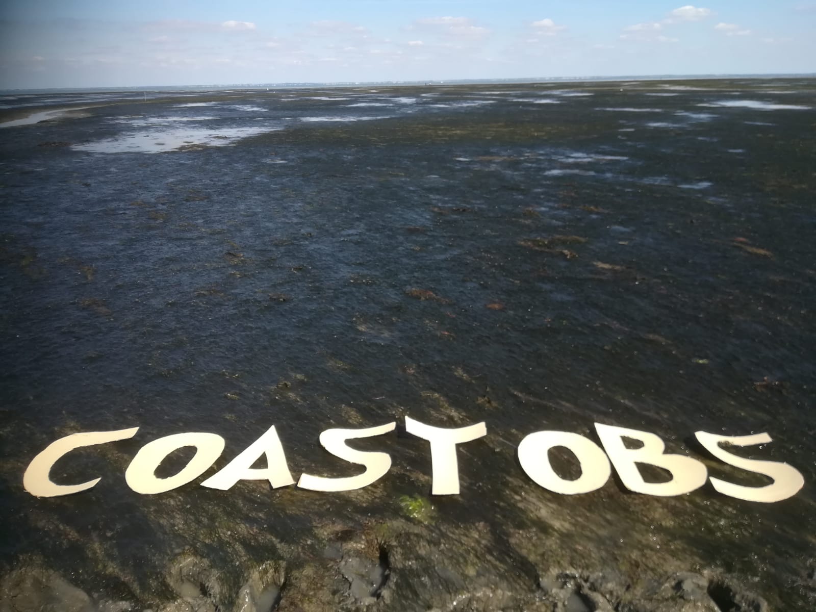
The University of Nantes started a fieldwork campaign for mapping seagrass at Bourgneuf bay and they sent a lovely photo to all CoastObs team!
]]>
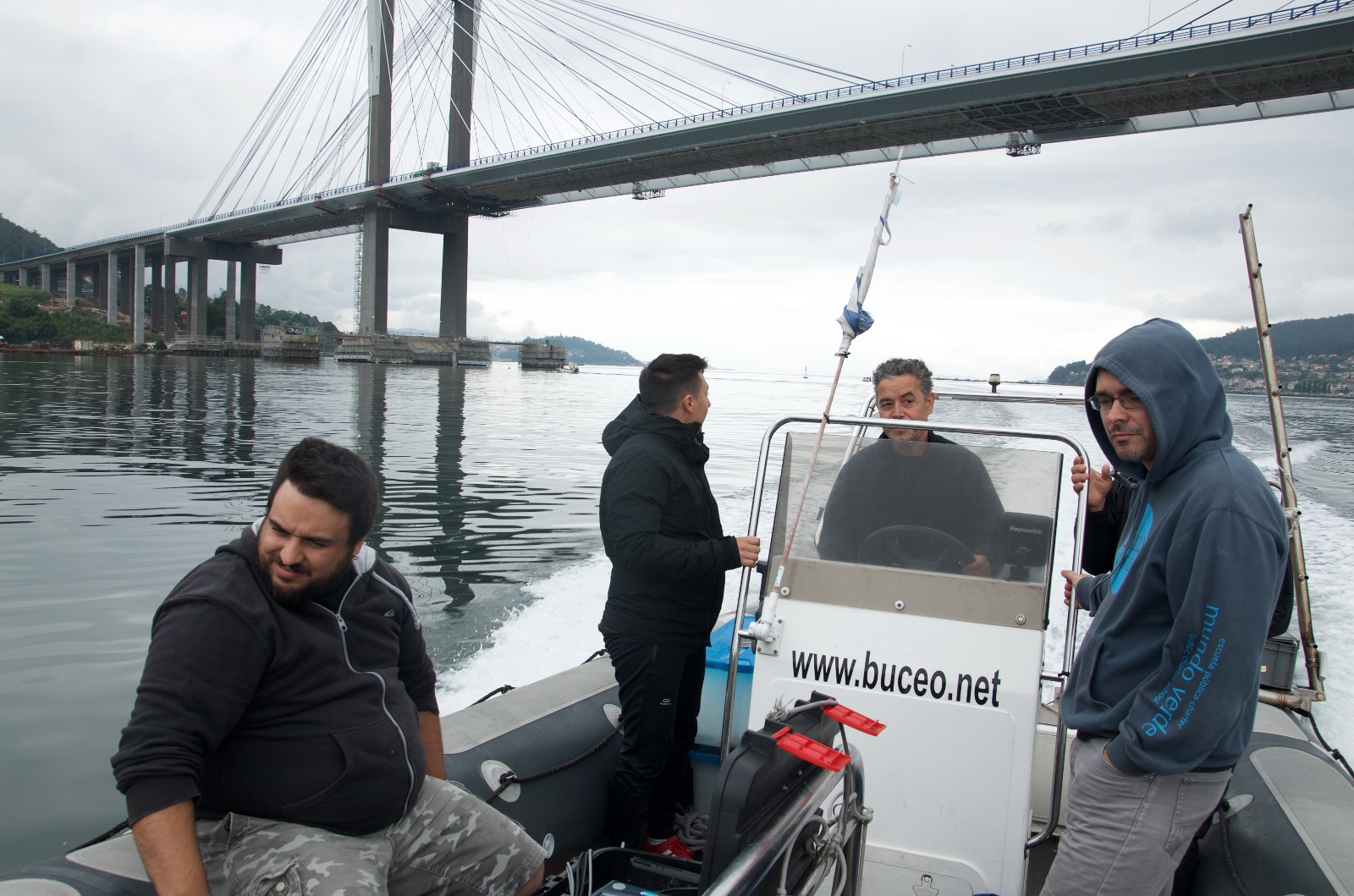
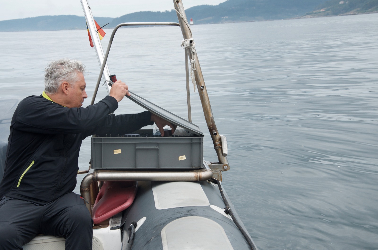
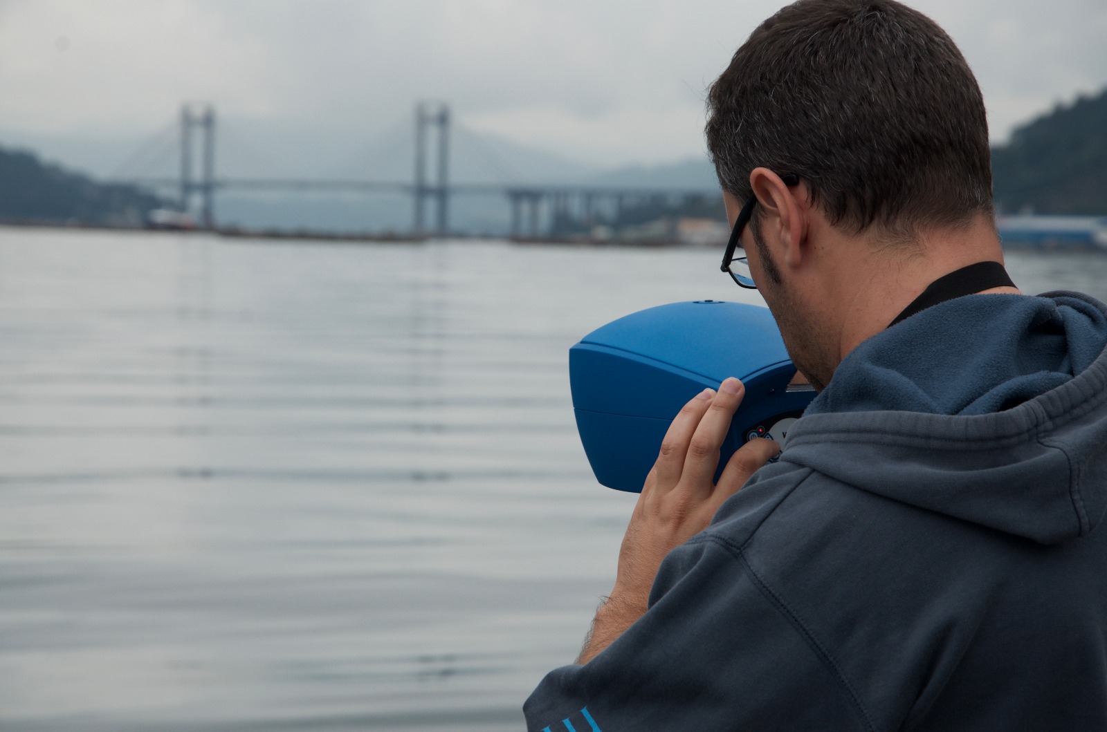
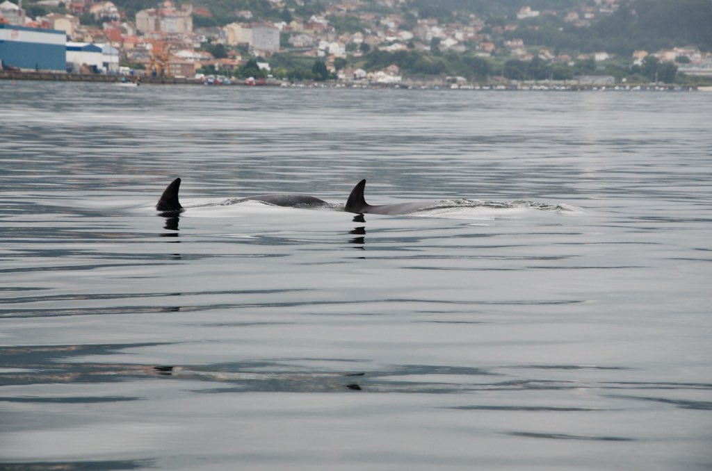
The Laboratory for Optical Biogeochemistry and Remote Sensing from Stirling University and the Remote Sensing and GIS Lab of Applied Physic Department of University of Vigo, went on a fieldwork campaign to characterize the biogeooptical parameters of the complex waters of the Ria de Vigo as part of the the validation of Copernicus EU Sentinel-2 and -3 data.
Check out some of the fieldwork campaign photos because they didn't only manage to spot a harmful algae bloom but also some dolphins!
]]>The Laboratory for Optical Biogeochemistry and Remote Sensing from Stirling University and the Remote Sensing and GIS Lab of Applied Physic Department of University of Vigo, went on a fieldwork campaign to characterize the biogeooptical parameters of the complex waters of the Ria de Vigo as part of the the validation of Copernicus EU Sentinel-2 and -3 data.
Check out some of the fieldwork campaign photos because they didn't only manage to spot a harmful algae bloom but also some dolphins!
]]>
The National Research Council - Department of Earth System Science and Environmental Technologies (CNR-DTA) and LOCHS Lab from Stirling University went on a fieldwork campaign for taking water samples of the Adriatic Coast and validate Sentinel 3 data.
Here some sneak peeks of sunny Venice and the water quality monitoring.
]]>Here some sneak peeks of sunny Venice and the water quality monitoring.
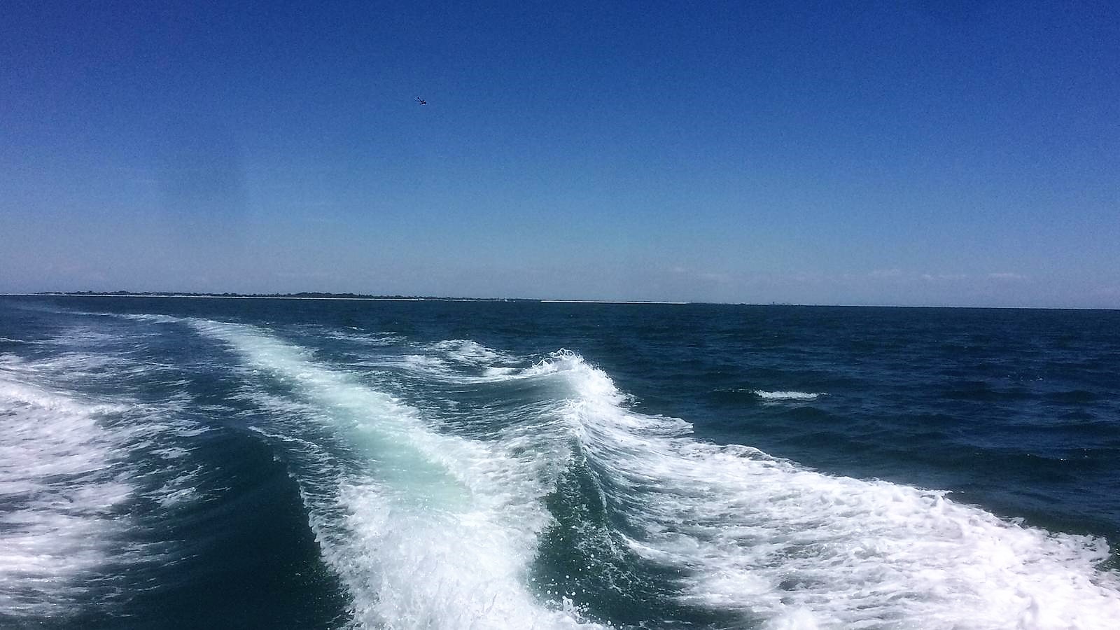
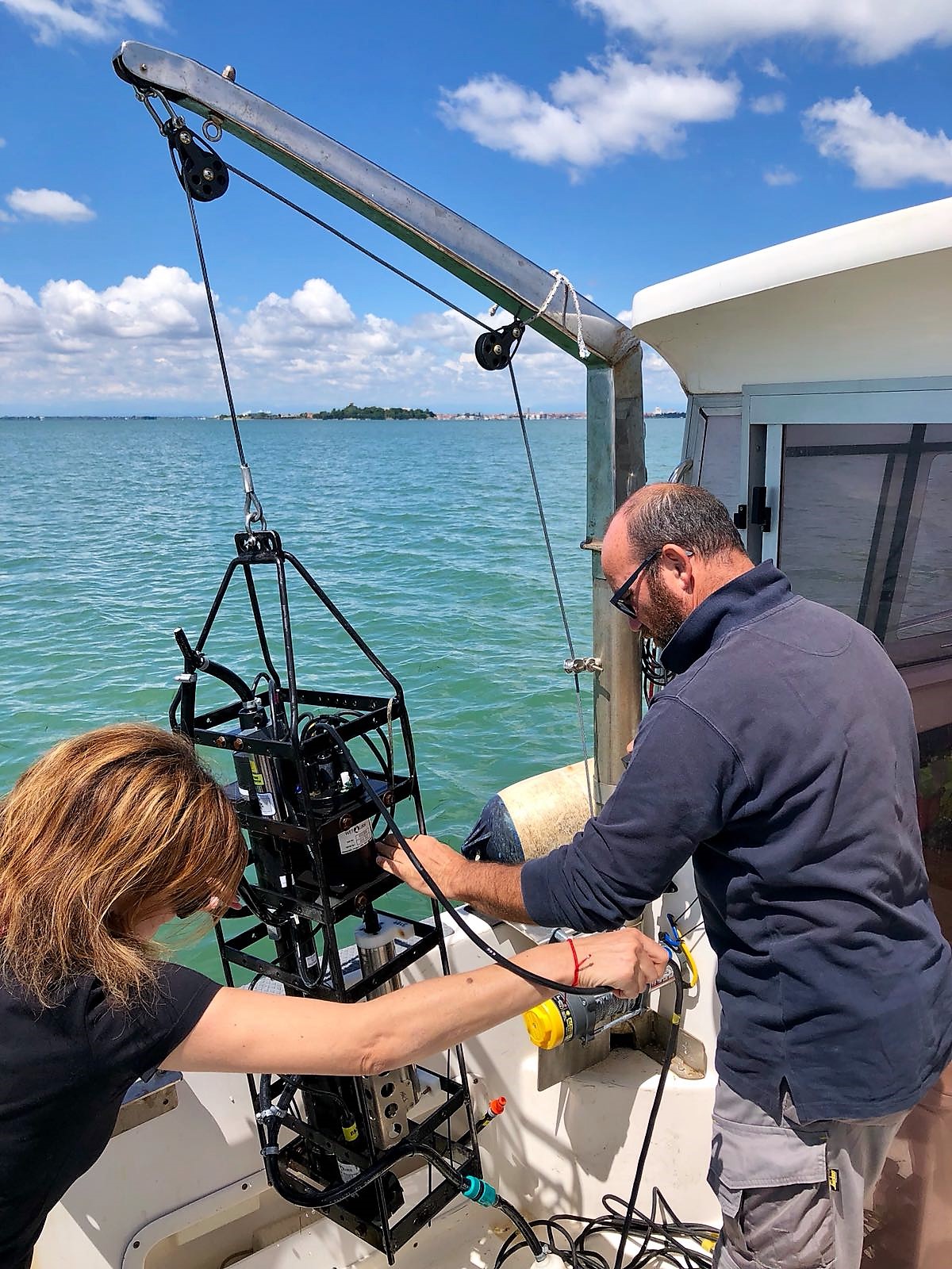
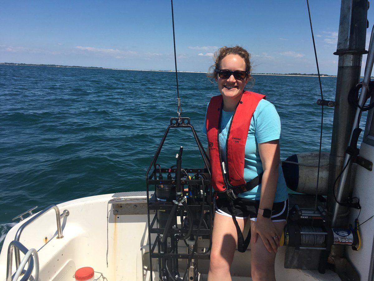
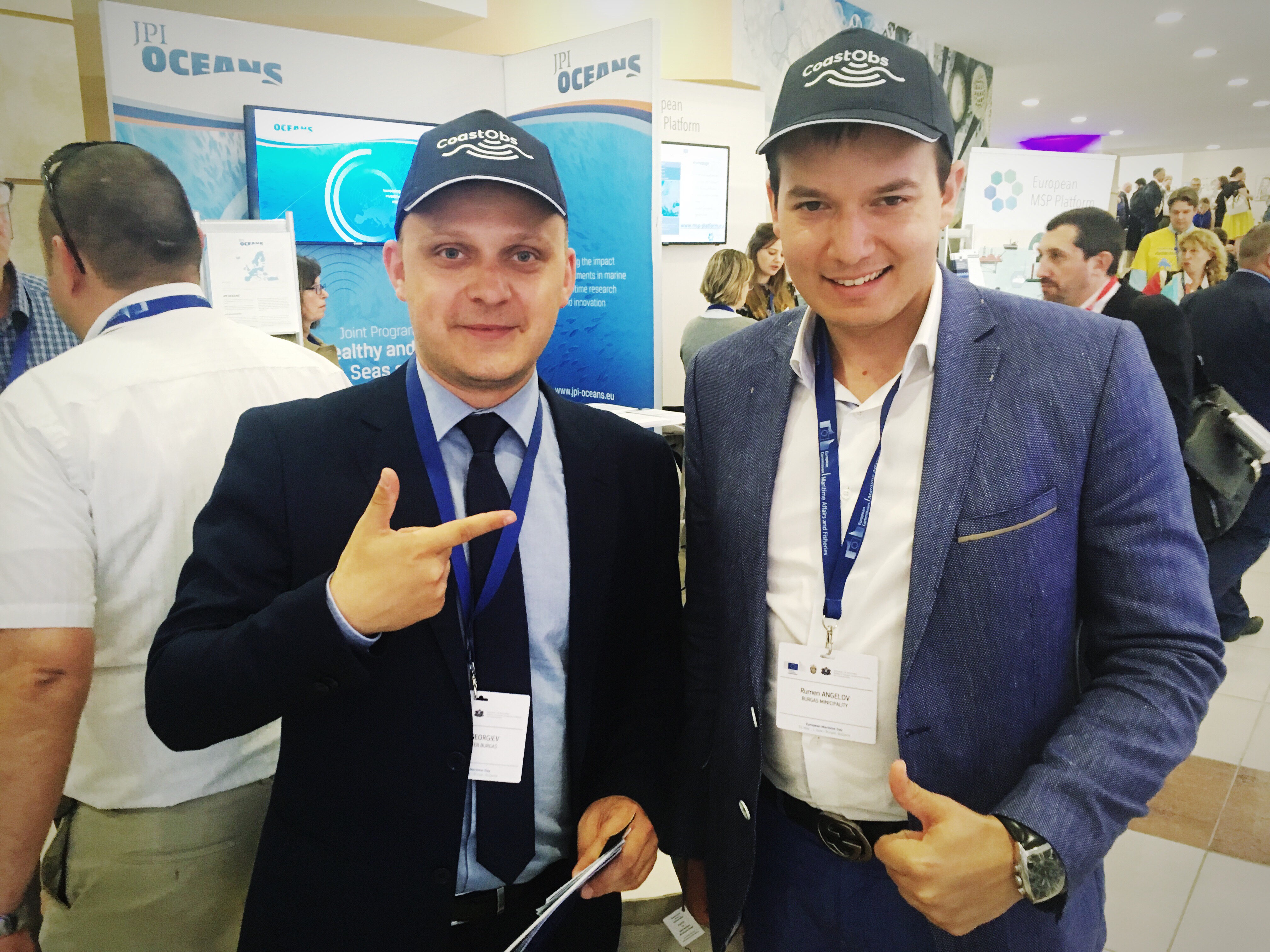
On its 11th edition, the European Maritime Day was held in Burgas, Bulgaria last May 31st and June 1st receiving about 900 participants. The most significant event related to maritime policy of the EU Member States, hosted also 18 stakeholder workshops and 27 exhibitors including CoastObs project!
]]>
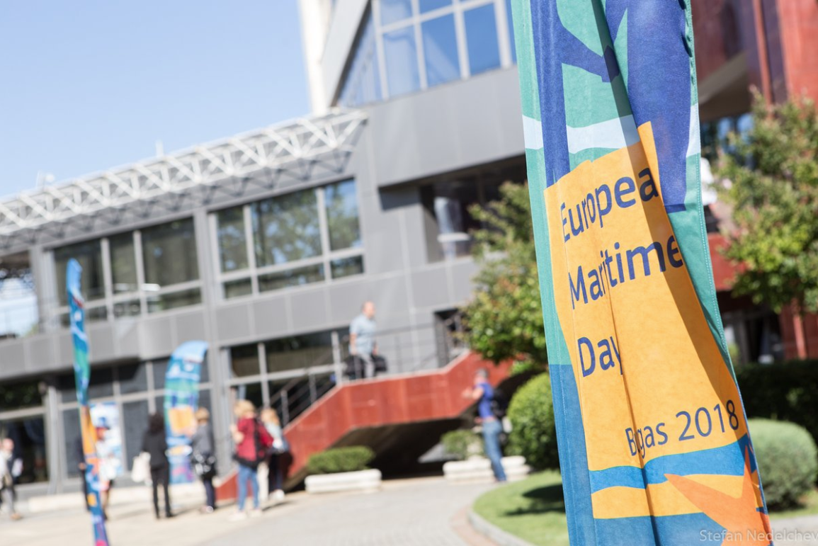
Photo: Stefan Nedelchev
The programme included discussions around Marine Spatial Planning, Sustainable Fisheries & Aquaculture, Regional Maritime Cooperation, Digitalisation & Data for Maritime Applications, Common Information Sharing Environment, Sustainable Tourism & Blue Bio-economy, Research & Blue Growth for mentioning a few.
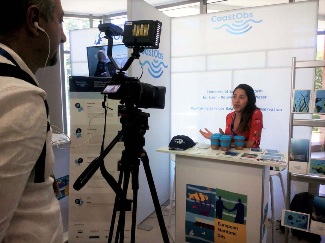
Participating in the exhibition, CoastObs was able to talk to many attendees and to increase the visibility of our project among the marine and maritime community in Europe. We gave away plastic free gadgets, gathered CoastObservers for our newsletter and we gave an interview to the EU Commission on Maritime Affairs & Fisheries.
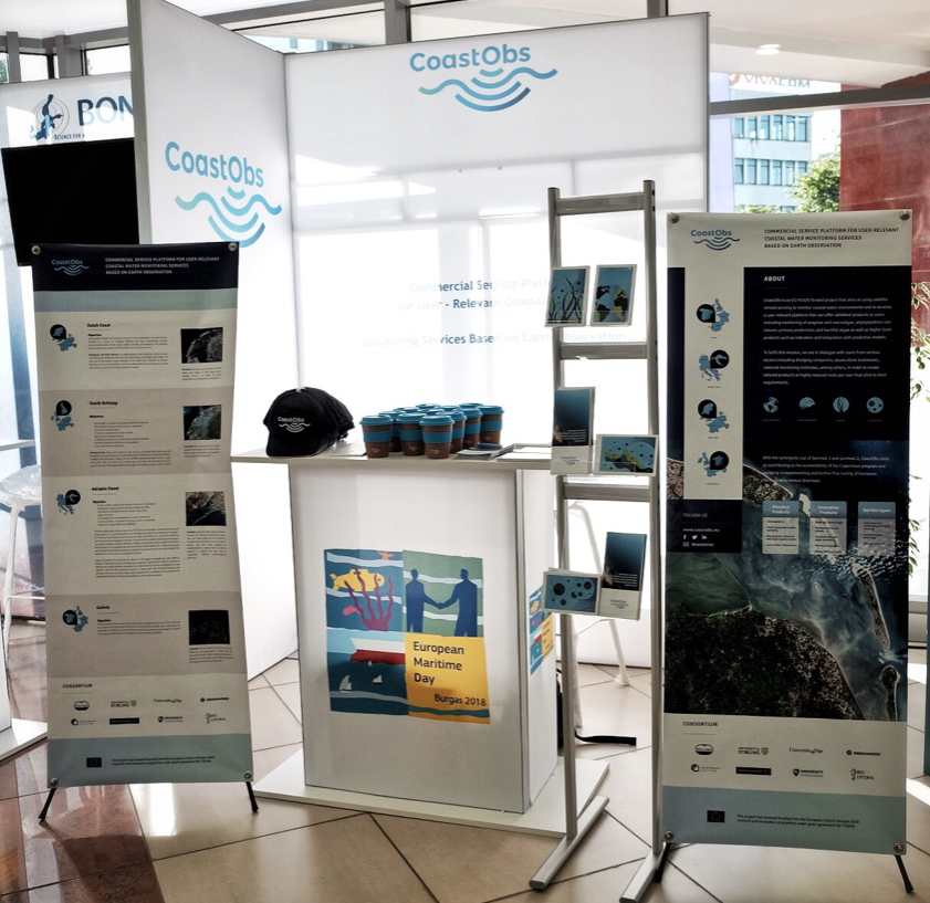
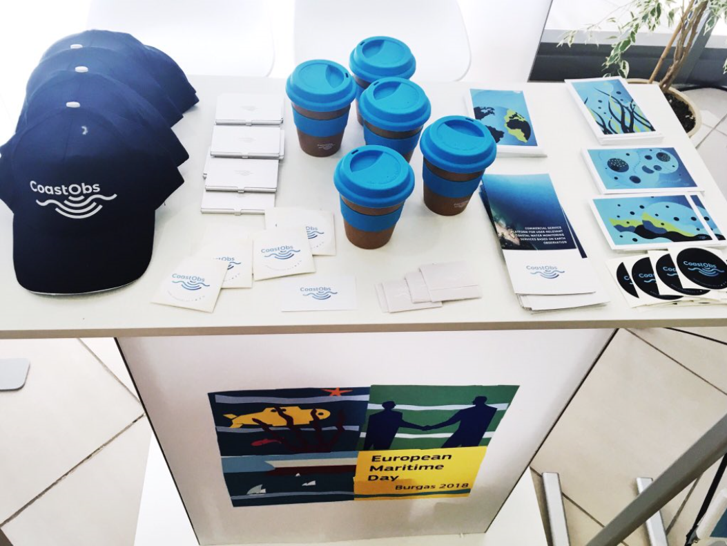
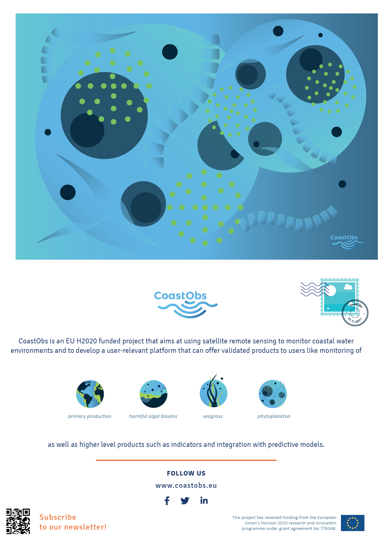
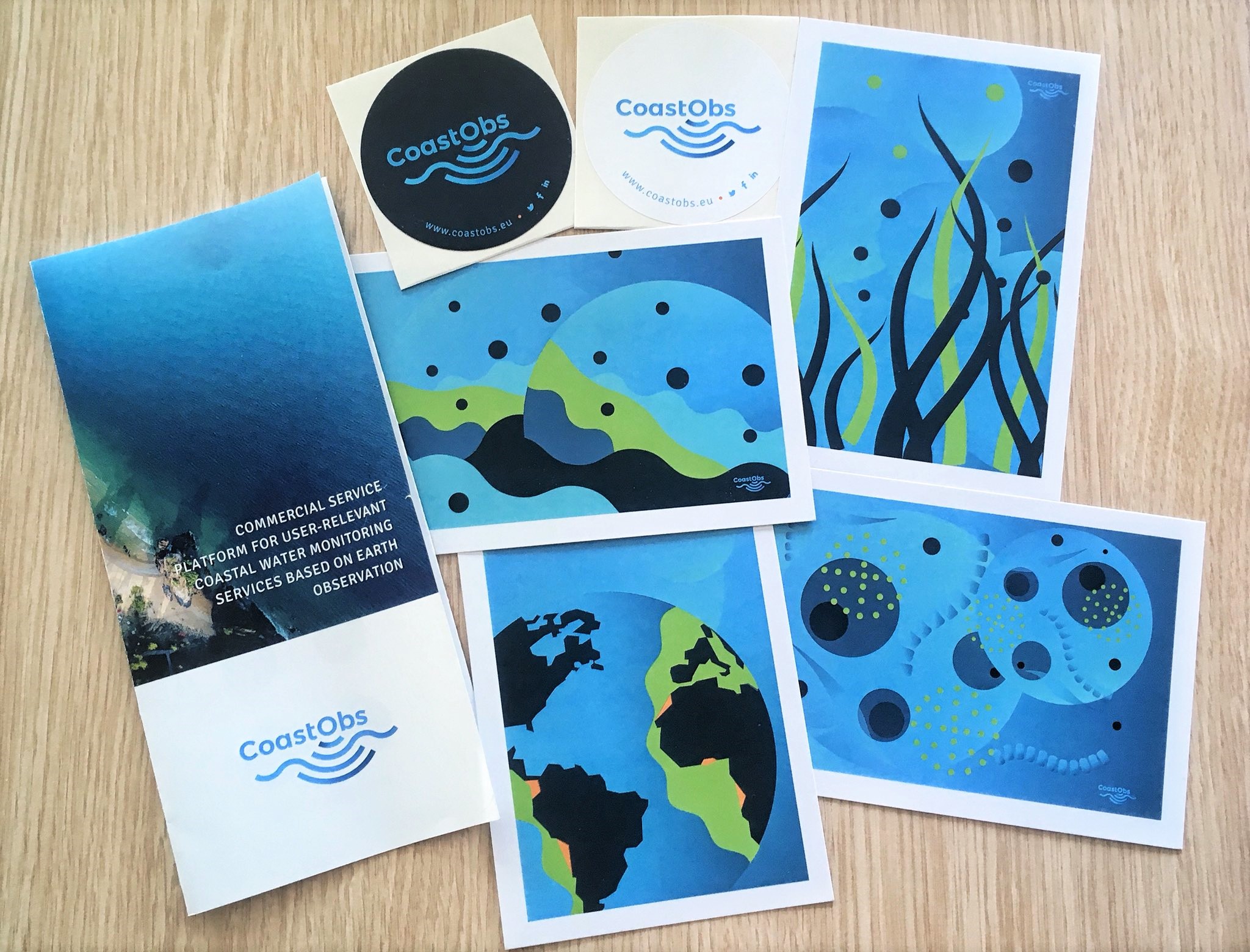
If you couldn't attend and you would like to see some of the flyers and postcards we distributed you can download the flyer from here or see the example of our cool postcard on phyoplankton below.
Thanks for all the attendees that stopped to say hi and those that we saw using our caps and our bamboo mugs at the coffee breaks and even in the cocktail party!
·
·
·
If you haven't followed us you can find us in Twitter, Facebook and LinkedIn.
Until next year in Lisbon!
]]>
On its 11th edition, the European Maritime Day was held in Burgas, Bulgaria last May 31st and June 1st receiving about 900 participants. The most significant event related to maritime policy of the EU Member States, hosted also 18 stakeholder workshops and 27 exhibitors including CoastObs project!
]]>
Photo: Stefan Nedelchev
The programme included discussions around Marine Spatial Planning, Sustainable Fisheries & Aquaculture, Regional Maritime Cooperation, Digitalisation & Data for Maritime Applications, Common Information Sharing Environment, Sustainable Tourism & Blue Bio-economy, Research & Blue Growth for mentioning a few.
Participating in the exhibition, CoastObs was able to talk to many attendees and to increase the visibility of our project among the marine and maritime community in Europe. We gave away plastic free gadgets, gathered CoastObservers for our newsletter and we gave an interview to the EU Commission on Maritime Affairs & Fisheries.
If you couldn't attend and you would like to see some of the flyers and postcards we distributed you can download the flyer from here or see the example of our cool postcard on phyoplankton below.
Thanks for all the attendees that stopped to say hi and those that we saw using our caps and our bamboo mugs at the coffee breaks and even in the cocktail party!
·
·
·
If you haven't followed us you can find us in Twitter, Facebook and LinkedIn.
Until next year in Lisbon!
]]>
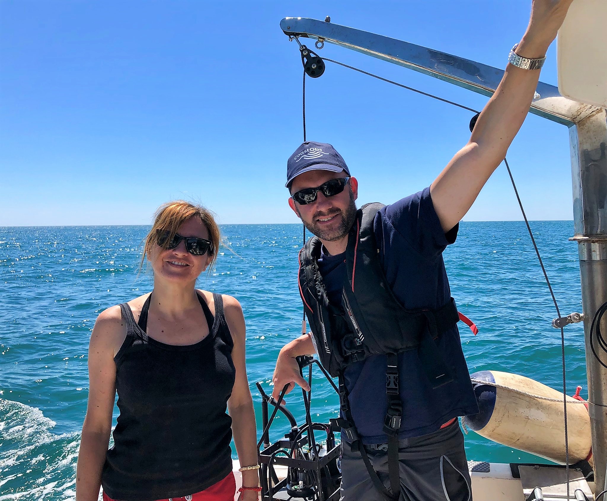
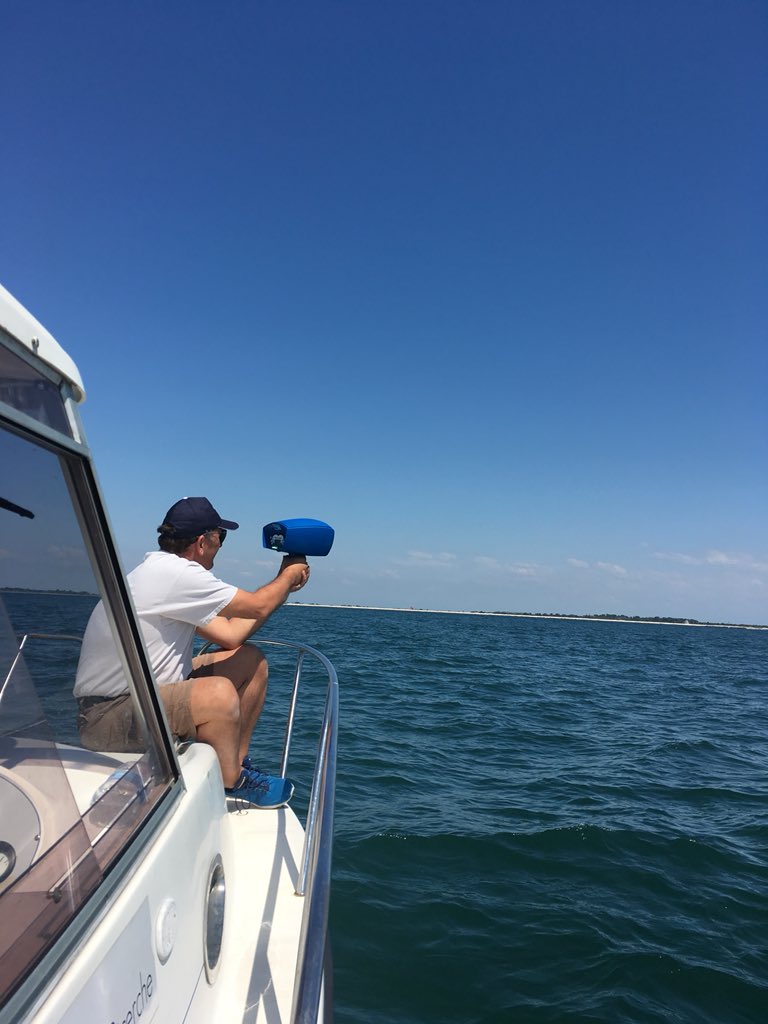
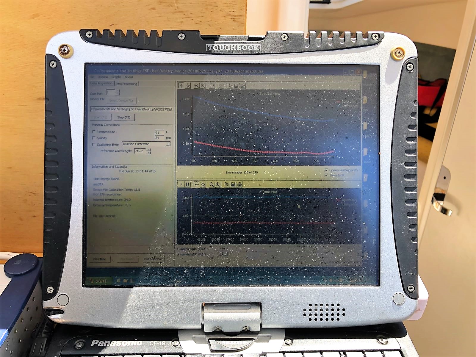
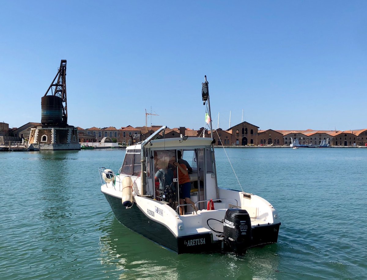
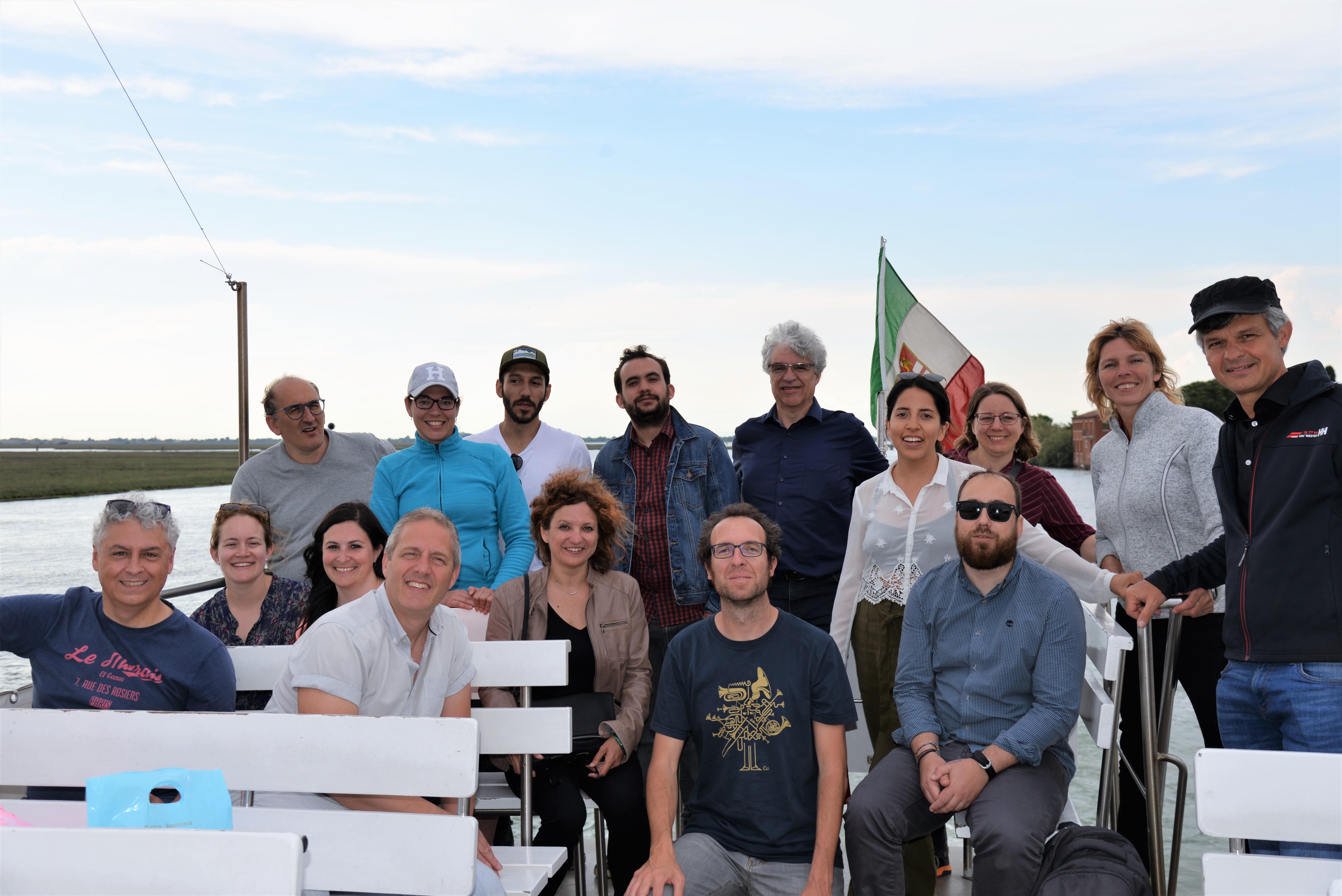
The first Project Meeting was hosted by CoastObs partner CNR in their Institute of Marine Sciences in Venice!
The three day meeting, which included a fieldtrip, was a success under sunny Italy. Click to check some photos!
]]>

All partmers were present and we discussed what we have achieved in the first six months and what is coming next for the upcoming period.
As part of the agenda we also had a fieldtrip in the Venice lagoon to be sure we all know how to use the WISP-3, a portable water quality spectrometer that measures the reflectance ('the colour') of the water. From this optical signal it instantly derives the concentrations of water quality indicators such as chlorophyll and suspended matter, without the need for laboratory analyses.
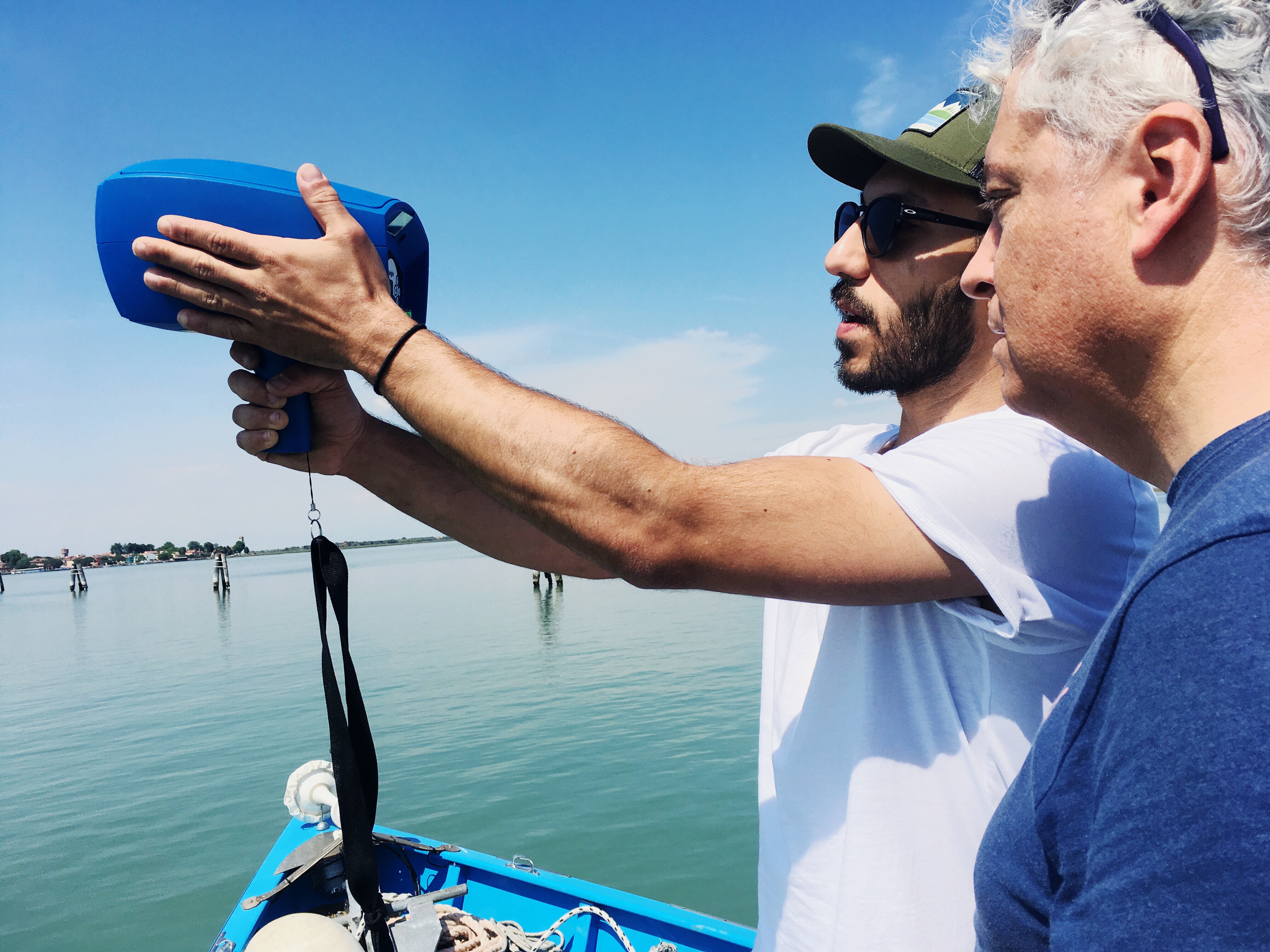
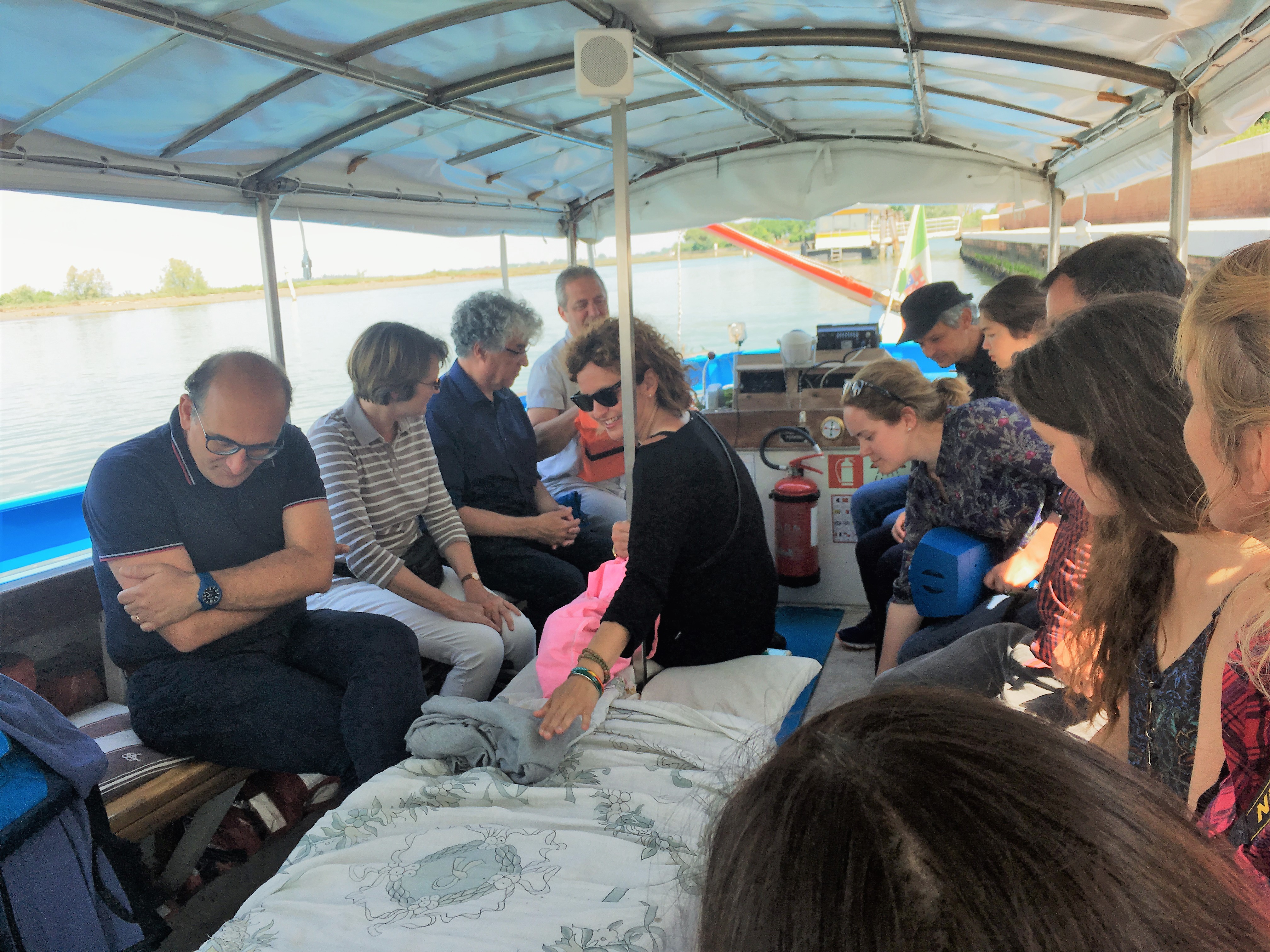
We are very excited about was upcoming in the next period. Stay tunned to see all the events we'll attend, the user we'll meet and the developments we'll achieve!
The first Project Meeting was hosted by CoastObs partner CNR in their Institute of Marine Sciences in Venice!
The three day meeting, which included a fieldtrip, was a success under sunny Italy. Click to check some photos!
]]>
All partmers were present and we discussed what we have achieved in the first six months and what is coming next for the upcoming period.
As part of the agenda we also had a fieldtrip in the Venice lagoon to be sure we all know how to use the WISP-3, a portable water quality spectrometer that measures the reflectance ('the colour') of the water. From this optical signal it instantly derives the concentrations of water quality indicators such as chlorophyll and suspended matter, without the need for laboratory analyses.
We are very excited about was upcoming in the next period. Stay tunned to see all the events we'll attend, the user we'll meet and the developments we'll achieve!
The European Commission's Directorate General for Maritime Affairs and Fisheries will bring, as in every year, the European Maritime Day! This year the EMD 2018 will be hold in Burgas, Bulgaria and it will take place on 31 May and 1 June 2018.
You can come and say hi to us as CoastObs will be at the exhibition area! We will have some gifts ready for those that stop by to find out about our project.
]]>The EMD 2018 conference programme includes:
- 18 stakeholders workshops covering a wide range of topical themes: Aquaculture and the blue bio-economy, on marine litter, digitalization and big data, marine research, innovation, ports, maritime security, spatial planning, offshore energy and ocean literacy.
- A political opening, with Karmenu Vella, European Commissioner for Environment, Maritime Affairs and Fisheries and Iskra Mihaylova, Chair of the Regional Development Committee at the European Parliament. Karmenu Vella together with Ivaylo Moskovski, Bulgarian Minister of Transport, Information Technology and Communications will welcome a number of fellow Ministers around the Black Sea to share their vision for the development of the Blue economy in the region (Ministerial Declaration towards a Common Maritime Agenda in the Black Sea).
- A plenary debate on what we termed ‘Big Bang Black Sea’ with leaders from the European Union, national governments, international organizations and NGOs to discuss challenges and opportunities for sustainable blue growth in the Black Sea.
- Three DG MARE info sessions on Measuring the EU Blue Economy, Turning Marine Litter into a sustainable business, and Financing strategic cooperation for Blue Growth.
- A plenary session on European funds post 2020 – what’s new? that will provide an indication on the expected future funding landscape for fisheries and blue growth as well as for maritime research and innovation.
- A networking reception in a splendid location looking out to the harbour, an exhibition and a pitch stage during the networking breaks.
You can find more about the event here.
See you in Bulgaria!
]]>
On the 9th of April, University of Nantes participated to a meeting organized by Shellfish Farmers (Regional Shellfish Committee) and Fisherman representatives to discuss a field sampling strategy to map wild oyster beds and macroalgae in Bourgneuf Bay, France. With the increase of water temperature, wild oysters progressively colonized intertidal areas, forming dense reefs.
]]>
After recurrent mass summer mortalities of cultivated oysters spat observed along the European coasts and a subsequent decline of the cultivated stock, oyster producers envisaged exploiting wild oysters as a resource to compensate for their losses. This situation induced conflicts with recreational and professional fishermen generating a need to map and manage wild oyster reefs.
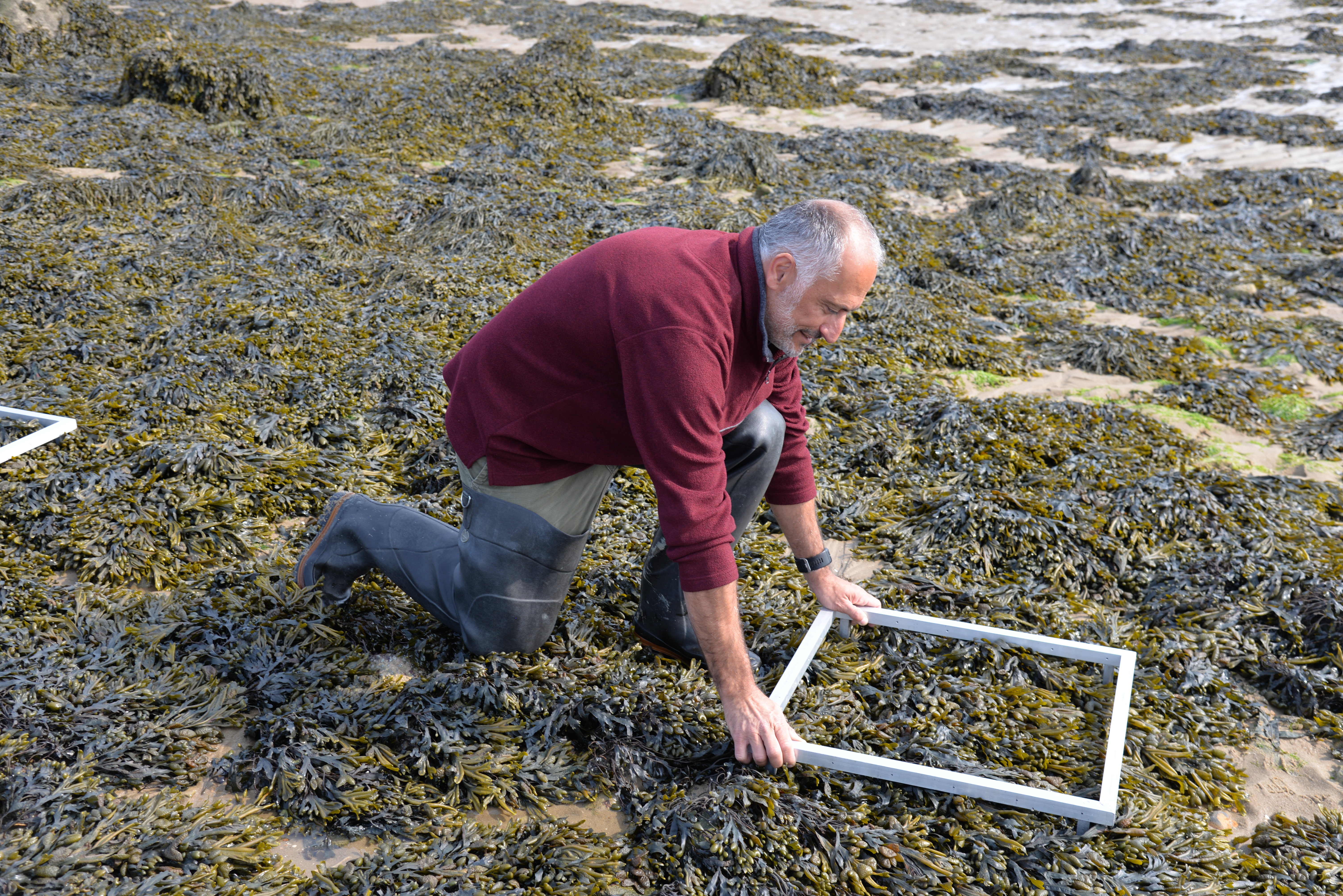
Dense brown macroalgal belts in the mid-intertidal area (Fucus sp., Ascophyllum nodosum)
Intertidal brown macroalgae (Fucus sp., Ascophyllum nodosum) are about to be exploited in Bourgneuf bay for a niche market in health food shops. Macroalgal maps are needed to identify the resource, set up an exploitation plan and deliver the first licenses. The professionals had already set up a sampling programme and we suggested to optimize the sampling effort using EO data. We presented spatial distributions maps obtained with Sentinel 2 in 2017 and explained that brown macroalgae were the best classified, but that the detection was less efficient for oysters beds using optical data.
To overcome a slight skepticism about EO products, we proposed to provide spatial distribution maps that would be processed using the most recent S2 image. On the 17th of April, an S2 image was acquired at low tide for Bourgneuf bay. The maps produced by the CoastObs consortium would be challenged by all the ground-truthing data collected by the Shellfish Farmers representatives.
We were invited to join them during a field campaign on Thursday the 16th of May. Percentage cover of different bottom types have been quantified at low tide and the accuracy of S2 maps will be tested by the end-users themselves.
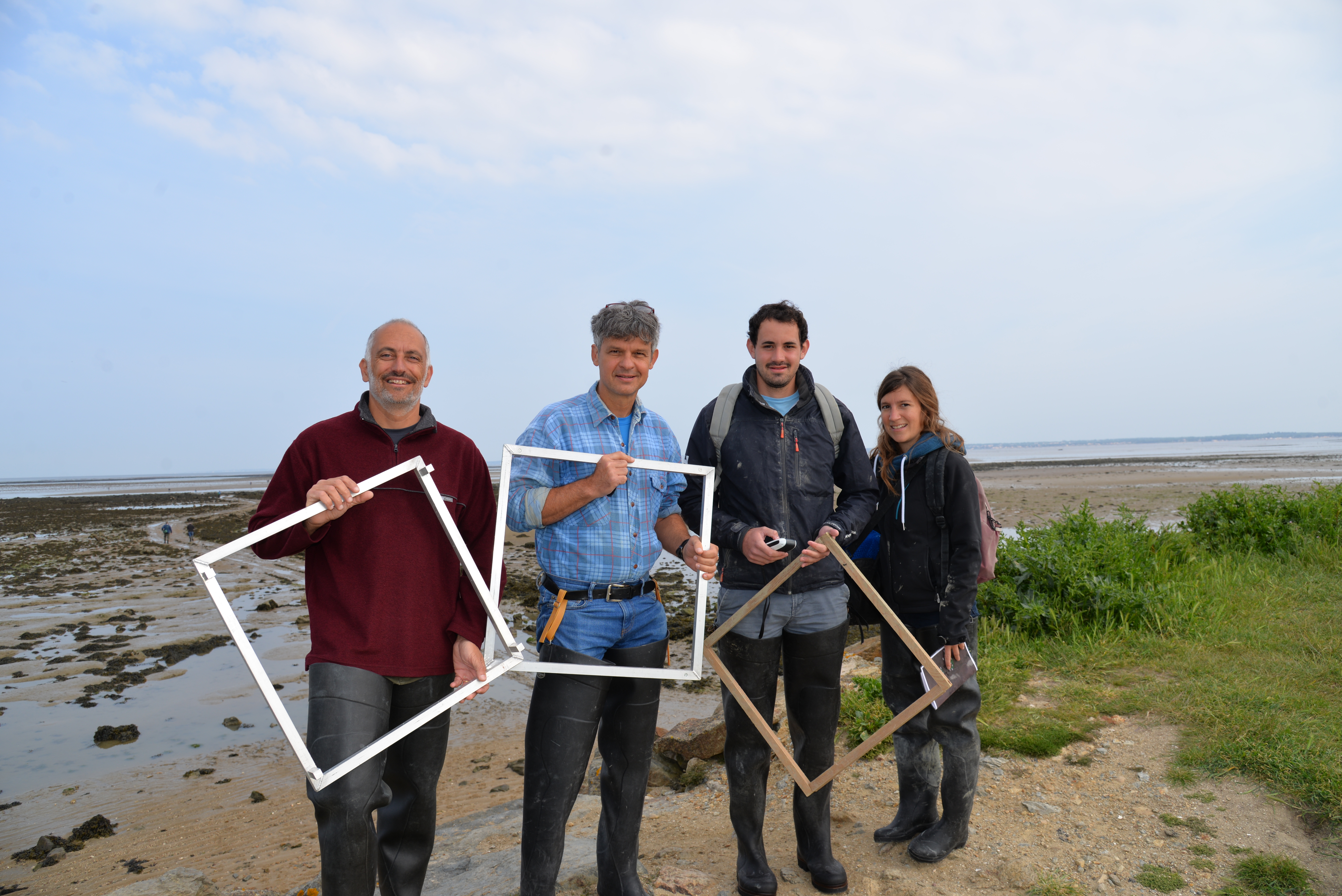
Join field campaign in Bourgneuf bay at low tide on the 16th of May : Appolline and Hugo from the CRC (Regional Shellfish Committee), Philippe and Laurent from Nantes University.
]]>
On the 9th of April, University of Nantes participated to a meeting organized by Shellfish Farmers (Regional Shellfish Committee) and Fisherman representatives to discuss a field sampling strategy to map wild oyster beds and macroalgae in Bourgneuf Bay, France. With the increase of water temperature, wild oysters progressively colonized intertidal areas, forming dense reefs.
]]>
After recurrent mass summer mortalities of cultivated oysters spat observed along the European coasts and a subsequent decline of the cultivated stock, oyster producers envisaged exploiting wild oysters as a resource to compensate for their losses. This situation induced conflicts with recreational and professional fishermen generating a need to map and manage wild oyster reefs.
Dense brown macroalgal belts in the mid-intertidal area (Fucus sp., Ascophyllum nodosum)
Intertidal brown macroalgae (Fucus sp., Ascophyllum nodosum) are about to be exploited in Bourgneuf bay for a niche market in health food shops. Macroalgal maps are needed to identify the resource, set up an exploitation plan and deliver the first licenses. The professionals had already set up a sampling programme and we suggested to optimize the sampling effort using EO data. We presented spatial distributions maps obtained with Sentinel 2 in 2017 and explained that brown macroalgae were the best classified, but that the detection was less efficient for oysters beds using optical data.
To overcome a slight skepticism about EO products, we proposed to provide spatial distribution maps that would be processed using the most recent S2 image. On the 17th of April, an S2 image was acquired at low tide for Bourgneuf bay. The maps produced by the CoastObs consortium would be challenged by all the ground-truthing data collected by the Shellfish Farmers representatives.
We were invited to join them during a field campaign on Thursday the 16th of May. Percentage cover of different bottom types have been quantified at low tide and the accuracy of S2 maps will be tested by the end-users themselves.
Join field campaign in Bourgneuf bay at low tide on the 16th of May : Appolline and Hugo from the CRC (Regional Shellfish Committee), Philippe and Laurent from Nantes University.
]]>
CoastObs, a 3-year EU-H2020 project focused on developing a user-relevant service platform for coastal water monitoring with validated products derived from Earth Observation (EO), was launched on 23-24 November in Wageningen, Netherlands, at the premises of the project coordinator Water Insight.
]]>
The mission of the CoastObs project is to use satellite remote sensing to monitor coastal water environments and to develop a user-relevant platform that can offer validated products to users including monitoring of seagrass and macroalgae, phytoplankton size classes, primary production, and harmful algae as well as higher level products such as indicators and integration with predictive models.
Why is this relevant?
The quality and ecological status of European and global coastal waters is an area of real concernbecause of the multiple and conflicting pressures from anthropogenic perturbation and environmental change. Coastal areas are among the most populated areas in the world and the continuing population growth is resulting in pressures for greater exploitation of the available ecosystem services.
The increased use of the coastal waters for energy and food production when combined with the impacts from pollutants and sediment from terrestrial catchments can result in profound societal impacts including eutrophication, changes in coastal hydro morphology, loss in habitats and human health risks.
Therefore, monitoring the multiple and often conflicting uses of the coastal zone including aquaculture, fisheries, wind, tidal energy, cooling waters, shipping and tourism is extremely important for aiming at a sustainable management of the these highly dynamic coastal environments. However, traditional in situsampling monitoring has been widely recognised as being inadequate in characterising the ecological status (both in space and time) of those environments resulting in significant uncertainties. Nevertheless, satellite remote sensing offers a real opportunity to provide synoptic coverage and quantify the spatial and temporal variability in the physical and biogeochemical properties of these vulnerable environments, which can be developed for more effective monitoring and improving the management and sustainable exploitation of the coastal zone.
How is it done?
The data derived from satellite images have become more and more accurate: more spectral bands allow distinguishing more substances in the water (chlorophyll, suspended matter, organic material, cyanobacteria pigment), and the higher spatial resolution makes monitoring of smaller water bodies possible. With the advent of the Copernicus Sentinel missions, operational water monitoring services for coastal waters comes within reach. The Sentinels missions of the Copernicus programme, give access to a fully operational EO capacity. With the information from Sentinel 2 and 3, CoastObs will develop user relevant (marketable) innovative EO-based information products and services that are not yet - as such - on the market and will create business opportunities based on existing information needs.
What will the approach be?
CoastObs partners will be in dialogue with users from various sectors in order to create tailored products at highly reduced costs per user that stick to their requirements. To demonstrate the multi-user approach of CoastObs and its operational services, the project will carry out four case studies in coastal areas where multiple stakeholders (dredging companies, aquaculture businesses, national monitoring institutes, etc.) have indicated a need for better information on water quality. The services will be assessed with respect to their quality, fitness for purpose and added value for the users and once they are validated and operationalized, the products will be included in a service portfolio for a market expansion. Lastly, CoastObs will provide training and consulting services for the target audiences dedicated to improving the capacity building of the users and to facilitate the up-take of the product after the duration of the project.
Who is CoastObs?
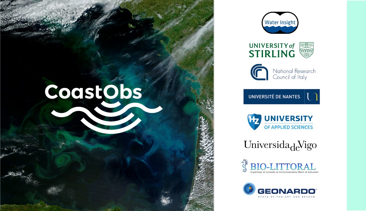
The project will be carried out by a consortium of 8 partners from 6 different countries:
- Water Insight
- University of Stirling
- National Research Council of Italy
- University of Nantes
- HZ University of Applied Sciences
- University of Vigo
- Bio-Littoral
- Geonardo
Keep in touch!
Twitter: @CoastObsProject
Facebook: @CoastObs
LinkedIn: @CoastObs
]]>
CoastObs, a 3-year EU-H2020 project focused on developing a user-relevant service platform for coastal water monitoring with validated products derived from Earth Observation (EO), was launched on 23-24 November in Wageningen, Netherlands, at the premises of the project coordinator Water Insight.
]]>
The mission of the CoastObs project is to use satellite remote sensing to monitor coastal water environments and to develop a user-relevant platform that can offer validated products to users including monitoring of seagrass and macroalgae, phytoplankton size classes, primary production, and harmful algae as well as higher level products such as indicators and integration with predictive models.
Why is this relevant?
The quality and ecological status of European and global coastal waters is an area of real concernbecause of the multiple and conflicting pressures from anthropogenic perturbation and environmental change. Coastal areas are among the most populated areas in the world and the continuing population growth is resulting in pressures for greater exploitation of the available ecosystem services.
The increased use of the coastal waters for energy and food production when combined with the impacts from pollutants and sediment from terrestrial catchments can result in profound societal impacts including eutrophication, changes in coastal hydro morphology, loss in habitats and human health risks.
Therefore, monitoring the multiple and often conflicting uses of the coastal zone including aquaculture, fisheries, wind, tidal energy, cooling waters, shipping and tourism is extremely important for aiming at a sustainable management of the these highly dynamic coastal environments. However, traditional in situsampling monitoring has been widely recognised as being inadequate in characterising the ecological status (both in space and time) of those environments resulting in significant uncertainties. Nevertheless, satellite remote sensing offers a real opportunity to provide synoptic coverage and quantify the spatial and temporal variability in the physical and biogeochemical properties of these vulnerable environments, which can be developed for more effective monitoring and improving the management and sustainable exploitation of the coastal zone.
How is it done?
The data derived from satellite images have become more and more accurate: more spectral bands allow distinguishing more substances in the water (chlorophyll, suspended matter, organic material, cyanobacteria pigment), and the higher spatial resolution makes monitoring of smaller water bodies possible. With the advent of the Copernicus Sentinel missions, operational water monitoring services for coastal waters comes within reach. The Sentinels missions of the Copernicus programme, give access to a fully operational EO capacity. With the information from Sentinel 2 and 3, CoastObs will develop user relevant (marketable) innovative EO-based information products and services that are not yet - as such - on the market and will create business opportunities based on existing information needs.
What will the approach be?
CoastObs partners will be in dialogue with users from various sectors in order to create tailored products at highly reduced costs per user that stick to their requirements. To demonstrate the multi-user approach of CoastObs and its operational services, the project will carry out four case studies in coastal areas where multiple stakeholders (dredging companies, aquaculture businesses, national monitoring institutes, etc.) have indicated a need for better information on water quality. The services will be assessed with respect to their quality, fitness for purpose and added value for the users and once they are validated and operationalized, the products will be included in a service portfolio for a market expansion. Lastly, CoastObs will provide training and consulting services for the target audiences dedicated to improving the capacity building of the users and to facilitate the up-take of the product after the duration of the project.
Who is CoastObs?
The project will be carried out by a consortium of 8 partners from 6 different countries:
- Water Insight
- University of Stirling
- National Research Council of Italy
- University of Nantes
- HZ University of Applied Sciences
- University of Vigo
- Bio-Littoral
- Geonardo
Keep in touch!
Twitter: @CoastObsProject
Facebook: @CoastObs
LinkedIn: @CoastObs
]]>