Significance
-
Protected habitat (EU directive);
-
Bioindicator of water quality (WFD), eutrophication, coastal erosion
Spatial/temporal resolution
-
10m (5 days)
Limitations
-
Sensor spectral resolution has an impact on the discrimination between different types of vegetation;
-
The presence of epiphytes can interfere with the signal.
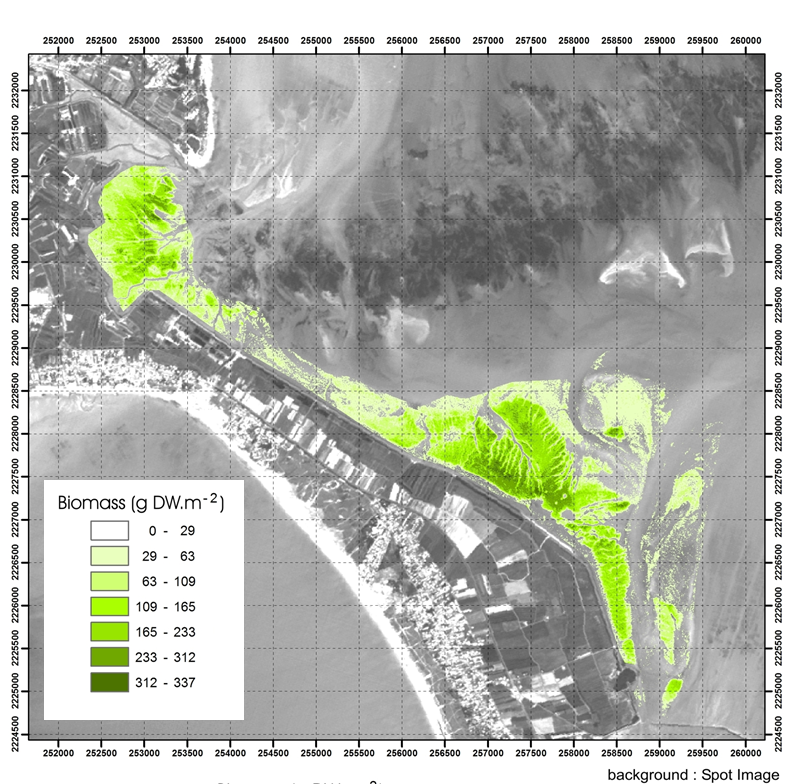
* Barillé L.,ROBIN M., HARIN N., BARGAIN A., Launeau P., 2010. Increase in seagrass distribution at Bourgneuf bay (France) detected by spatial remote sensing. */Aquatic Botany/*/92, 185-194.//
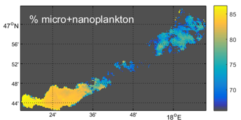
2. Phytoplankton size classes (PSC)
Significance
-
It represents thresholds in the continuum range of phytoplankton size fractions from 0.2 μm to 200 μm (normally pico- nano- and micro plankton);
-
Carbon cycling, fisheries & aquaculture management.
Spatial/temporal resolution
-
300m (daily)
Limitations
-
Limitations specific to different retrieval approaches and availability of representative datasets.
* EU FP7-SPACE INFORM project
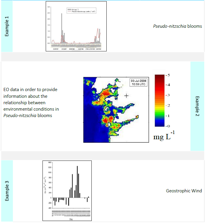
3. Harmful / indicator species (HAB)
* EU FP7-SPACE INFORM project
4. Phytoplankton primary production
Significance
-
Primary production is an indicator of ecosystem metabolism and the transfer of carbon between the atmosphere and ocean and its uptake by phytoplankton.
Spatial/temporal resolution
-
300m (daily)
Limitations
-
The models require accurate retrieval of Chl, Kd and SST are sensitive to variability in the photosynthetic rates of the phytoplankton community.
* EU FP7-SPACE INFORM project